| Geography at Mach 2!! | |
|
|
|
|
April 26, 2002:
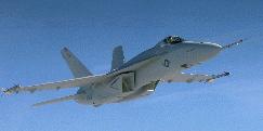
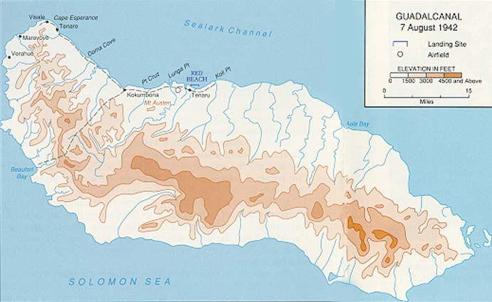
This concept evolved rather naturally from our use of flight simulators, Joe's interest in World War II, and our curiousity about the island of Guadalcanal in the South Pacific. "Fly-throughs" of Digital Elevation Model (DEM) features are starting to be used quite commonly in modern GIS systems to understand complex spatial relationships. However, a GIS fly-through is usually along a predetermined path. With the flight simulators, we have a tool that can that can help with understanding spatial and ecological relationships that is under complete user control! And fun to boot! Historical Development. Rather that just flying from point "A" to point "b", we came up with the idea of exploring while flying. We fly on two simulators networked together, so its rather fun to be flying side by side. On an overflight of Guadalcanal the previous day we both had became disoriented, but were growing increasingly curious about the amazing amount of detail in the geographic scenery in the flight simulators. Turns out that the geography is extremely realistic and based on actual Digital Elevation Models (DEMs). On that day, we had spotted a significant feature (an airfield) but weren't sure where we were or it was and we ended up flying in a big circle (visual flight thru valleys - not following compass). Guadalcanal is a big island and Joe came up with the idea of flying it in F-18 Hornets so we could circumnavigate in a reasonable amount of real time - at least following the coastline we couldn't get lost! Thus was born our project "Geography at Mach 2", hopefully the first of many such flights and the discovery of a very wonderful and exciting tool for teaching geopgraphy!!! (and many related fields). With adrenaline going even. Nothing like an F-18 for that!! The day began with instructions in the form of Mission Orders sealed in a manila envelope, along with two maps which we were to fill in with details. We based our reconaissance flight on the topography in the 1942 Map of Guadalcanal from the excellent Perry-Castańeda Library Map Collection at the University of Texas, and also Arcview GIS shapefile coverage that I was able to obtain from the GIS Data Depot to make our own map. Joe had the idea to fly the mission in the F-18. At Mach 2, the exercise took just about the right amount of time (10 min of flying)...actually a little bit longer would have been better. However, it was vastly fun, and the F-18 is a wonderful tool for exploring geography. Want to zoom climb to check out the top of a 10,000 foot mountain range in a couple seconds?? No problem!! Very, very interesting perspective. Flying "through" the geography gives a very wonderful perspective - very real, and it almost is of course. Flying together on our networked computers in Microsoft Combat Flight Simulator we are able to travel and explore together. We each made notes on our maps during our flight (we "flew" from separate rooms) and then met after we landed for a "debriefing" session to compare our findings and update our map. We plan to continue the genre, exploring other islands in the vicinity, and perhaps elsewhere in the world. ***flash*** Apparently our discovery of using flight simulators to visualize terrain data is out there on the cutting edge of GIS technology: Virtual Reconnaissance of Geospatial Data Using Flight Simulators, from Earth Observation Magazine (a GIS trade publication). Now the professionals are onto it too!! To see some other examples of "fly-throughs" (done with custom software, not flight simulators) that don't take too long to download see: Terrain Visualization for National Park Service Interpretive Programs. Associated Resources on Guadalcanal we used:
|
Back to: Logs, Field Trips and Other Events
Contact: Fritz Funk (fritzf@alaska.net)